Forget latitude and longitude–how about how long it takes you to get there?
For centuries, people have relied on the same types of maps. Whether a map is interactive or hand-colored in a book, it offers latitude and longitude as the key indexes for getting from point A to point B.
But designer and software engineer Peter Liu thinks he’s come up with an entirely new way to think about mapping. What if our maps were arranged by time, instead of space?
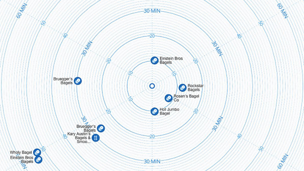
“We still use a traditional map–a shrunken down version of the physical world–to approximate the time it takes to get somewhere,” Liu says. “I thought, we’re using distance as an imprecise and poor proxy for travel time. Why not cut to the chase and visualize travel time?”
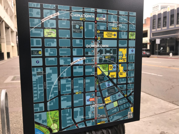
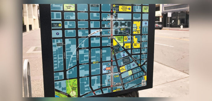
The easiest way to picture this type of map is to imagine the signs you see in big cities in their central tourism neighborhoods. These maps show the surrounding area in a more traditional map, with concentric circles superimposed on top of it to give tourists a sense of how long it will take them to get somewhere. But these are imperfect–they mark the 5-minute walking circle as the crow flies. So Liu has created a time map composed entirely of concentric circles that indicate how long it will take you to get somewhere–independent of how far away it is. It’s meant, in some ways, as a tool to help you choose where you’re going. If you want a coffee shop within a five-minute walk, you can search for “coffee” and the map will pull up all the coffee shops in your area, arranged by how long it will take you to get there. Then, in choosing a place to go, it’ll show you more traditional, location-based directions.It’s slightly different from other mapping services like Google Maps. In essence, if you’re using an app like Google Maps, you likely already know both point A and point B. The time map is designed for instances when you don’t know the point B yet–it helps you decide what point B makes the most sense for the situation you’re in.
Liu is a team member for the location platform Mapbox‘s research and development team, tasked with anticipating what kinds of products the company’s clients might want in the future. Mapbox, which supports the Weather Channel’s mobile app and recently built a store locator tool for Android, creates many of the tools other companies use to support their mapping services.
Liu’s time map is just a prototype–the search function, for instance, doesn’t work very well at the moment (if you search for lunch, it’ll only pull up options that have the word “lunch” in their name). Liu says the search is entirely based on Four Square’s API; he focused on building the map itself. That means that whatever app or service the time map was integrated into, it would use the search function for that service. If it was part of Yelp, it would use Yelp’s search. It’s a plug-and-play approach that mimics Mapbox’s philosophy as well, he says, because the company builds tools that their clients can mix and match with other services and platforms.
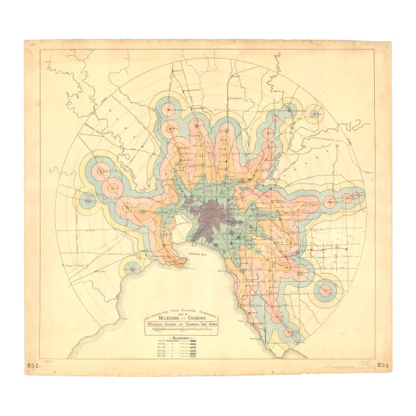
That means that this time-based mapping idea could one day find its way into the Yelp app–if I got my way. Because how often do you want to find a place to eat that you know is within a five-minute walk? All the time. Liu also imagines the tool being integrated into the travel industry, like with hotels or Airbnb because it would be especially useful in an unfamiliar city.Liu has been talking to Mapbox’s mobile team about turning it into an app, but for the time being, he’s focusing on the next logical step: adding streets to his map of concentric circles. He imagines a map where you’re in the middle, and all the streets around you radiate outward, represented not by the physical length of the road but the time it would take for you to traverse that road to your destination.
–
This article first appeared in www.fastcodesign.com
Seeking to build and grow your brand using the force of consumer insight, strategic foresight, creative disruption and technology prowess? Talk to us at +9714 3867728 or mail: info@groupisd.com or visit www.groupisd.com

